


Way++ | Community based outdoor navigation app for iPhone and iPad
Developer: Ewoud Wijma
First release : 17 Nov 2014
App size: 41.2 Mb
Way++ is the outdoor navigation app which put websites with geodata on the map and put your right in the middle of it. To follow you and to lead you. On Open Street Maps, on Mapbox maps, on satellite maps, on maps you design or customize.
Way++ allows an unlimited set of geographical data to be imported and shared with others and strongly supports user participation. You are invited to define it, to be part of it, to support it, to use it, to have fun with it. Way++ is based on Credits: Free credits to get you started, earn credits by posting geolinks and when others download your links, buy credits and spend credits when using data or functionality.
What others say:
● I use this a lot in geocaching and defining routes. The program lets you easily plan routes because it contacts waypoints and geocache sites. You can also easily create a route from a to b and create a gpx. I like the OSM map also as it is the finest in terms of detail and completeness. This is for me the finest app that Ive seen on the iPad until now!
● Above all, compliments for this application, easy to use, convenient, and it works great. I have great admiration for this!
Main features:
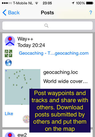
●Way++ community: Posting Geolinks to Geodata from Geosites. Posts will be shared with all users of Way++. Posts can be liked and you can comment on posts, similar to social network platforms. You can select posts on different criteria including the posts, most close to you.
●Main screen buttons to access functionality in ‘one click’ .
●Tracking: Based on the Tracking Pack in GPS++. Start and stop tracking. Track calendar and sharing of your tracks.
●Navigation: Show estimate to complete, direction and distance to nearest waypoint and track.
●HTML Geodata: With HTML Geodata you cannot only extract geodata from the known formats as GPX and KML but also from HTML pages. HTML pages are checked if they contain latitude/longitude references. Allows you to post your webpage with geodata in Way++. You get a new audience for your website (we have about 40.000 downloads so far), you get notified when somebody else put your locations on a map and you see comments and likes on your post (and you earn Way++ credits as well!).
●Simple credit system instead of multiple in app purchases. You get credits for free, you can earn credits if you add new posts or if others download your posts, you spend credits if you use data and functionality and you can buy credits if you need more. Purchases made in GPS++ and Marine++ can be used to create free credits in Way++.
●To-do list, containing possible new features in Way++. You can like items and add items. The items with the most likes will be build first! To know what is going on, check the current status in the to-do list inside Way++, including the items which are currently build, tested and in production.
● Use of GPS in the background can impact your battery life.
● In the future, GPS++ and Marine++ will be merged into Way++, redesigned and rebuild according to the principles of Way++. Version 2.0 of Way++ is just the beginning. If you want full functionality, download GPS++ or Marine++. If you want to be part of developing a new app, download Way++.
Try Way++ Today!!!